NASA recently launched its newest satellite which is part of the space agency's SWOT mission in an attempt to survey millions of Earth's rivers and lakes and transform our view of water on our planet.
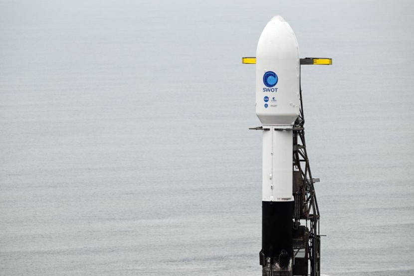
The Surface Water and Ocean Topography (SWOT) mission were carried onboard SpaceX's Falcon 9 rocket, which launched from Space Launch Complex-4E at Vandenberg Space Force Base in California on Dec. 16, at 6:46 a.m. ET.
Surveying Earth's Water
NASA and the French space agency CNES were responsible for developing the mission in partnership with the Canadian Space Agency (CSA) and the United Kingdom Space Agency. In a statement sent via email, UK Science Minister George Freeman said that water is quickly becoming a major geopolitical resource.
The official noted that climate change had caused droughts and floods and global interest in water temperature and flows SWOT has become the first global survey of our planet's surface water. It would work on measuring how oceans, lakes, reservoirs, rivers, and wetlands across the globe change over time.
The data that the mission will provide is expected to assist scientists in better understanding the effects of climate change and better predicting global flood risks, said NASA. The satellite is equipped with a radar instrument named Ka-band Radar Interferometer (KaRIn), which was designed to survey at least 90% of the Earth's surface and measure water height, as per Gizmodo.
The instrument will use two antennas found on either side of the satellite to bounce radar pulses off the water's surface and then receive the return signal. The satellite will operate in a non-Sun synchronous orbit. This means that it will pass over the same area of our planet at the same mean solar time.
The orbit of the satellite will be at an altitude of just over 554 miles, which is from where it will work on surveying the Earth's surface water at least twice every 21 days. SWOT will also send back roughly one terabyte of unprocessed data every single day.
According to CNN, on top of being critical for the survival of life on our planet, water also shapes our weather and climate as it stores and moves carbon and heat that has been trapped in the atmosphere by greenhouse gas emissions.
SWOT Satellite
Surveying these crucial resources can help scientists better understand the global water budget, assess our main sources, how these sources are changing, and the impacts that they will have on different environments.
One key question that scientists have had is about the heat exchange between Earth's atmosphere and the global ocean and how it might accelerate global warming. In a statement, a research scientist at the Sea Level and Ice Group in NASA's Jet Propulsion Laboratory, Benjamin Hamlington, said that they were going to be able to see things that they could never see before with the help of the SWOT satellite.
Despite the recent launch, it will take a few months before the SWOT satellite comes fully into operation. Its French-built KaRIn has extremely long booms that need to be unpacked first before it can start surveying Earth's waters, BBC reported.
© 2026 HNGN, All rights reserved. Do not reproduce without permission.


