GUATEMALA - Continuously spitting up lava for several days now, satellite images revealed that a trickle of magma is currently from the source of Pacaya Volcano.
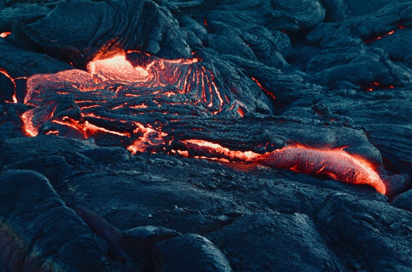
Despite having an elevation of more than 2,500 meters, the lava flow which is currently running at the northeast side of the volcano is now 700 meters long.
Some claim that the height of the lava flow is still not alarming due to Pacaya's elevation, but regardless of its height, it is still alarming as the Lava started to pour from its mouth since June 7, Sunday, and has been pokily erupting since then.
According to Daily Express, based on the current information from the (INSIVUMEH) or Guatemala's Instituto Nacional de Sismología, the Pacaya which first erupted 23,000 years ago is now spewing white and blue gas from its mouth.
On the Volcano Discovery's website, they shared that the satellite image taken from June 8 depicts a formation of the lava flow on the North part which is an estimated 550m long.
Moreover, INSIVUMEH mentioned that in the Northeast flank lava flow remains active and still increasing its length which is now around 700 m long.
As observed from the Mackenney summit crater, the Strombolian activity continues with incandescent materials thrown to a height range of 50 meters to 100 meters.
Read also: First American Woman to Walk on Space Becomes First Woman to Dive Into Deepest Part of the Ocean
On the other side, south to southwest direction is where plumes were dispersed wherein there is an emission of white and blue gas along with steam plumes.
They also added that the seismic stations notate internal tremors linked with degassing, constant Strombolian explosions, and the rise of magma in the area.
Nearby volcano of Pacaya is the El Fuego which is the most dangerous volcano in Guatemala, El Fuego began its most recent eruption cycle in 2002.
In 2018, the El Fuego put its name on the headlines as it violently erupted prompting warnings.
The volcano sent ash rocketing close to four miles above its summit along with generated super-heated pyroclastic which flowed down to the mountain and entered local communities on June 3, 2018.
The eruption was tagged as a minimal warning however around d 200 people died because of the chaos brought by nature's eruption leaving the people living in the vicinity a little time for a possible evacuation.
Along with many South American countries, Guatemala is seismically active in terms of Volcanos and earthquakes as it is located at the top of the Ring of Fire.
Stretching from New Zealand running down towards the East coast of Asia going to Canada and the United States of America all the way down to the southernmost part of South America, the Ring of Fire, aside from being the largest it also the most active fault line in the world causing over 90 percent of the earthquakes in the world.
Any movement on the plate that is included in the Ring of Fire can cause great damage even it is only from a slight movement still it can result to volcanic activity, massive tremors and tsunamis as there is a total of 452 volcanoes sitting upon the Ring of Fire which is impossible to predict aa to when it will erupt.
© 2026 HNGN, All rights reserved. Do not reproduce without permission.


