The National Geographic Society, one of the only nongovernmental map policy bodies in the world, said Wednesday it had made no formal decision on Crimea, despite erroneous reports claiming it had remade its maps to depict Crimea as part of Russia, according to The Washington Post.
Wikipedia is also going through the same dilemma, the Post reported. As of Thursday morning, both Ukraine's Wikipedia page and Russia's Wikipedia page claim Crimea, and things have gotten pretty heated in the comment sections.
"We are waiting to see the results of Friday's [Russian] parliamentary vote," said Juan Valdes, the Geographer of the National Geographic Society, according to the Post. "If it is formally annexed, our policy will dictate that we shade the area gray, signifying that it is a disputed territory."
Valdes said that change would be accompanied by text explaining the dispute, the Post reported. National Geographic has followed this convention on many occasions, including when mapping Abkhazia, Gaza and the West Bank, South Ossetia, and a number of other disputed territories.
Explaining its policy further, National Geographic released a statement on Tuesday saying: "National Geographic Society's cartographic policy is to portray to the best of our ability current reality. Most political boundaries depicted in our maps and atlases are stable and uncontested. Those that are disputed receive special treatment and are shaded gray as 'Areas of Special Status,' with accompanying explanatory text."
"In the case of Crimea, if it is formally annexed by Russia, it would be shaded gray and its administrative center, Simferopol', would be designated by a special symbol. When a region is contested, it is our policy to reflect that status in our maps. This does not suggest recognition of the legitimacy of the situation," the statement read.
U.S., European, and other world leaders have said they will not recognize Crimea as part of Russia, following what many have described as an "illegal" referendum earlier this week, according to the Post.
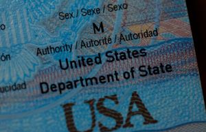
U.S. State Department press spokesperson Peter Velasco told National Geographic: "We reject the Russian attempt to annex Crimea; therefore, we have no plans to change U.S. government maps," the Post reported.
According to National Geographic's long-standing cartographic policy, while a map "strives to be apolitical," the Society's policy "is one of portraying the world from a de facto point of view; that is, to portray to the best of our judgment the current reality," according to the Post.
© 2026 HNGN, All rights reserved. Do not reproduce without permission.