(Photo : csbwv / Pixabay)
Ancient Egyptians were very secretive about their mysterious pyramids, but the secret was the River Nile which acted as a delivery waterway that had already disappeared over time.
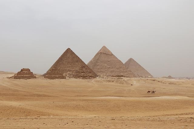
Ancient Egyptians used the Nile to move the material needed to construct the mysterious pyramids. The study's authors presume that this is one of several hypotheses relating to their construction that are actually plausible.
Secrets of the Ancient Pyramids
It is entirely unknown how these monuments to the dead were even constructed with the technology available 4,500 years ago, reported Science Alert.
Incredibly, Egyptians used ramps to move stone blocks weighing several tonnes. According to the study, one solution was the setting in which engineers constructed the Giza pyramid. All of the stone blocks were transported using portions of the Nile.
Hader Sheisha, a physical geographer from the University of Aix-Marseille in France, and other authors of the study published in PNAS suggested that ancient Egyptians would use the yearly Nile flood waters to develop a port structure at the base of the Giza plateau where the mysterious pyramids are. The idea has been explored about the environment and the landscape 4,500 years back in the past.
Egyptologists believed that the builders made waterways connected to the River Nile so they would always be full during floods. It would be nice to have a hydraulic lift that would speed up and increase the number of large blocks brought to the Giza Plateau, according to Aera Gram.
Nile River as Ancient Port Complex
Since Khufu, Khafre, and Memkaure were only 7 kilometers from the current Nile Rivers, this port complex would be used to gather the materials needed for them. Barges shouldn't be able to sink if these inlets are deep enough.
Drilling for core samples led to the discovery of an ancient Nile rock layer that would have touched the base of the pyramid complex. River Nile
Read Also: Kim Jong-un Net Worth 2022: How Wealthy Is North Korea's Leader?
There are theories about how the Egyptians planned the water access to the Giza complex because northern Egypt was experiencing some extremely drastic climatic changes at the time of their construction. Heit el-Ghurab, the Lost City of the Pyramids, which housed seasonal workers, was repeatedly destroyed by flash flooding.
To learn more about the condition of the Nile about a thousand years ago, investigators used fossilized pollen grains. These pollen grains are used to recreate ancient climates and less arid landscapes, per The Conversation.
They found out from the cores with pollen from today's Giza floodplain east of the pyramid complex that there were more plants on the river banks at the lake edge then. It showed the ongoing body of water that grew and cut through the Giza floodway long ago.
Following the Khufu branch of the Nile River's River levels over 8,000 years of Egyptian dynastic history and contrasting their research results to other ancient records.
The Nile would be at its lowest point at the Khufu branch between 1349 and 1338 BCE, corresponding to the end of the dynastic period. Chemical markers in mummies and ancient records both showed these changes.
This study also mentions that the use of the Nile River was extended to the Dashur pyramids, which are located south of Giza. One impact of the study is that more complexes, like the Dashur necropolis, were built.
Ancient Egyptians raised the mysterious pyramids from the waters of the river Nile via waterways and ports already eroded by time, showing the changes over several millennia.
Related Article: Countless Space Rocks Have Struck Planet Earth for Millennia, But How Many so Far?