Researchers are using rocks and reading their history as the basis in order to paint a picture of the time when the Red Planet had liquid water on its surface, tracing back to billions of years ago.
Exposing cliffs on Mars, the new highly detailed images and data reveal the first evidence of rivers that existed for more than 100,000 years on the red planet's surface 3.7 billion years ago, as supported by a study published on Tuesday in the journal Nature Communications.
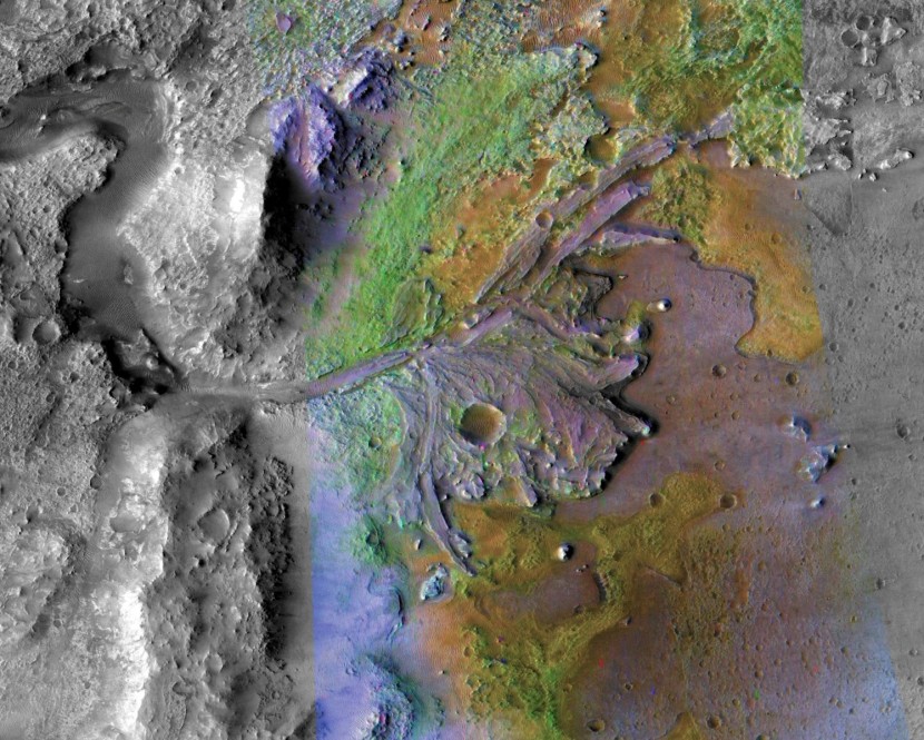
Using imagery and topography captured by NASA's Mars Reconnaissance Orbiter's HiRISE camera, the international team of scientists studies a rim of the Hellas Basin in the southern hemisphere of Mars.
Being one of the largest craters in the solar system that stretches 5.6 miles from the crater to rim, the Hellas impact crater has long been of interest to researchers because of its enormous size bringing such attraction for research.
It can be seen in the rock, the ancient evidence that the existence of the large lake, deltas, rivers, and channels is real, as the rocks made a revelation that Mars must have had a significant and sustained water presence in its past.
Twice the height of the famous White Cliffs of Dover along the English coastline, the researchers pointed their focus to a rocky cliff in the red planet which is about 656 feet high. There, the rocks can be traced as old as 3.7 billion years, which is composed of sediment accumulated over time and they are like the rocks available on Earth that were formed by the help of rivers.
Researchers shared in their study that the exposed cliff faces on the red planet reveal rivers that continuously shifted their gullies, which creates sandbanks, alike to the Rhine or the rivers which can be found in the area of Northern Italy.
Senior scientist at the International Research School of Planetary Sciences in Italy and study author, a geologist at Utrecht University in the Netherlands, Francesco Salese stated that what they have found out is not like reading a newspaper, but the extremely high-resolution imagery permitted them to read the rocks as if they are standing very close to the cliff.
He also added that unfortunately, they do not have the ability to climb and to look at the finer-scale details, but the striking resemblance to sedimentary rocks on Earth leaves very little to the imagination.
Layers of history are recorded in these sedimentary rocks, and the researchers were able to determine that the channels of the ancient river in Mara were around nine or 10 feet, or having several meters depth.
The analysis of these layers on Mars can shed more light on the red planet's history, much like geologists used sediment layers on Earth to fully understand how our planet evolved over time and envision what it was like millions and even billions of years ago.
Co-author of the study and a geologist at Utrecht University, William McMahon also shared that since we have now the technology to extend this methodology to another terrestrial planet, Mars, which hosts an ancient sedimentary rock record which extends even further back in time than our own.
Related article: Geologists Detect Possible Tectonic Activity on the Moon
© 2026 HNGN, All rights reserved. Do not reproduce without permission.


